

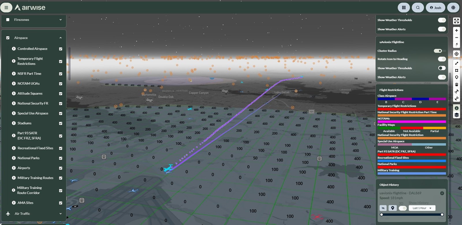
uAvionix and Airwise Solutions have partnered to strengthen airspace awareness and support the growth of Beyond Visual Line of Sight (BVLOS) drone operations at Skyway Range in Oklahoma. The collaboration integrates uAvionix’s FlightLine surveillance data with the Airwise platform and its Nexus common operating picture (COP), giving drone operators access to real-time information on nearby aircraft within a unified operational environment.
The integration is designed to provide operators with low-latency, deduplicated surveillance data, improving awareness of cooperative aircraft operating in the surrounding airspace. This capability is particularly important as commercial and government drone programmes increasingly move toward routine BVLOS operations.
uAvionix’s FlightLine system uses its nationwide FlightStation network to collect Automatic Dependent Surveillance-Broadcast (ADS-B) information across both 978 MHz Universal Access Transceiver (UAT) and 1090 MHz Extended Squitter (ES) frequencies. The network provides visibility of cooperative aircraft, including traffic operating at lower altitudes that may be relevant to drone missions.
Through a secure API integration, FlightLine surveillance data is delivered directly into the Airwise platform. This allows users to incorporate airspace intelligence into their existing operational workflow without having to establish and maintain a separate network of surveillance sensors.
The companies say the combined capability can help improve situational awareness, support operational decision-making and assist with identifying potential conflicts between crewed and uncrewed aircraft.
The technology is being deployed at Skyway Range, a 1,200-square-mile BVLOS flight-test environment in Oklahoma. The facility supports commercial companies, government organisations and research institutions developing and testing autonomous aviation technologies across rural and urban environments.
uAvionix has previously contributed technology to Skyway Range, including capabilities supporting command and control and Detect-and-Avoid requirements for BVLOS operations. The latest partnership expands that capability by connecting surveillance data with UTM functionality through the Airwise operational environment.
The integrated architecture is also intended to support organisations as they scale their drone programmes. Rather than being limited to individual flights, the system can support larger enterprise operations involving multiple aircraft, locations and missions.
As regulatory frameworks and industry adoption continue to advance BVLOS operations, reliable airspace surveillance and integrated traffic-management capabilities are becoming increasingly important. The uAvionix-Airwise partnership aims to address this requirement by combining real-time surveillance with a unified operational picture.
The integrated capability is available to Skyway Range participants and enterprise customers using the Airwise platform and Nexus common operating picture, providing a foundation for more scalable and connected BVLOS drone operations.
